News

Outreach planned for Upper Deschutes Basin study

A study of the Upper Deschutes Basin in Oregon is examining several options for increasing water storage.

Mateusz Perkowski

Capital Press

Published on September 18, 2017

Federal authorities will soon be sharing preliminary findings of a water study of Oregon’s Upper Deschutes Basin with landowners and other affected parties.

The U.S. Bureau of Reclamation and regional partners will use the input to complete their analysis of water management in the basin, whose water supply demands are eventually expected to exceed supplies by 230,000 acre-feet a year.

One component of the report, which is due in mid-2018, will examine the feasibility of expanding water storage in the region.

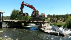
The possibilities being studied include raising an existing dam to expand the Haystack Reservoir south of Madras, Ore., or building a new upstream facility.

The study is also looking at creating a new “Monner” reservoir east of Madras or restoring storage in the Prineville reservoir that’s been lost to sedimentation.

Water conservation and water transfers are also being examined in the study, said Mike Relf, project manager with the Bureau of Reclamation’s Pacific Northwest regional office.

“Storage is just one part of the basin study,” Relf said.

The goal is to lay out the benefits and challenges of potential storage options, rather than make any recommendations, he said.

“The idea is not to promote any particular idea,” Relf said.

Building or expanding water reservoirs would entail environmental studies and funding processes that would likely require decades to complete, he said. “Storage would by far be the longest-term idea out there.”

It’s worthwhile to take a closer look at storage possibility, the likelihood of actually starting construction is a long shot, said Mike Britton, general manager of the North Unit Irrigation District, which is one of the partners participating in the $1.5 million study.

Aside from bureaucratic and financial hurdles, storage projects are often unrealistic because they’d flood existing infrastructure, such as gas pipelines and power transmission lines, he said.

“Those types of obstacles are potential deal stoppers,” Britton said.

California, for example, has a long list of potential storage options that haven’t been built for decades, he said. “I doubt we’d be that much different here, unfortunately.”

The prospect of expanding the Haystack Reservoir, however, is making at least one landowner nervous.

Kenny Reed, who owns a ranch abutting the reservoir, worries an expansion would disrupt habitat for bald eagles that he’s conserving under an agreement with the federal government.

Reed has expressed his concerns to the Bureau of Reclamation, which has acknowledged there’s a conservation plan for the area.

“The entire ranch is designated as bald eagle habitat,” Reed said. “We didn’t go through a 20-year process to say it doesn’t matter anymore.”


Shon RaeOutreach planned for Upper Deschutes Basin study
Read More

DAM REMOVAL Historic Cline Falls Dam Being Removed

Central Oregon Daily

August 1, 2017

DAM REMOVALHistoric Cline Falls Dam Being Removed Cline Falls has long been a popular stop for tourists and locals alike in the Redmond, Oregon area. Now, some of the area's original beauty is being restored as crews begin the work of removing the dam that has been in place since 1913.Central Oregon Daily's Anyssa Bohanan has the story.

Posted by Central Oregon Daily on Tuesday, August 1, 2017


Shon RaeDAM REMOVAL Historic Cline Falls Dam Being Removed
Read More

Dam removal underway near Redmond

Photo credit: Scott Nelson & Deschutes Historical Society

Dam removal underway near Redmond

107-year-old Cline Falls Dam served war effort, a nonexistent town

Bend Bulletin/August 2, 2017

REDMOND — A 107-year-old dam to the west of Redmond, one that provided hydroelectric power to Redmond Airport during World War II and hoped to do the same for a Central Oregon town that existed only on paper, is being demolished.

Beginning this week, workers began to remove Cline Falls Dam, using excavators and sandbags to temporarily alter the flow of the river.

Craig Horrell, district manager of Central Oregon Irrigation District, which owns the site of the dam, said removing the nonoperational, wood and concrete dam on the Deschutes River will hopefully make it easier for trout and other fish species to travel downriver.

The demolition is slated to be finished near the end of this month, and will leave the Mirror Pond dam as the only remaining barrier to safe fish passage between Wickiup Falls and Lake Billy Chinook, Horrell said.

“To remove a dam on the Deschutes is a huge deal,” he said.

Cline Falls Dam was originally built in 1910 by Pilot Butte Development Company, which was sold to the Des­chutes Irrigation & Power Company, the precursor to COID. Horrell said the dam was initially built to provide water and energy to the community of Cline Falls, which received a town plat to the west of Redmond, but never became a town.

“It just didn’t work out the way the forefathers hoped,” Horrell said.

In 1942, the dam was commissioned to provide additional energy for Redmond Airport, which was used by the federal government during World War II, according to Horrell.

During the 1950s, a 5-foot-tall concrete dam was built to augment the wood and rock structure that was already in place.

Cline Falls Dam’s 100-year lease expired in 2010, and the dam has not been operational since. In 2014, the dam became the subject of a lawsuit between PacifiCorp — the parent company of Pacific Power, which leased the site — and COID, which alleged that the utility left the site of the old dam contaminated and in disrepair.

In December 2015, PacifiCorp agreed to pay the irrigation district $1.65 million as part of a settlement, according to The Bulletin’s archives. Horrell added that the​​ settlement was used to fund the dam removal project, which he estimated at $800,000.

“In my mind, it’s a bargain,” Horrell said.

He added that the surrounding area, which includes a parcel owned by the Bureau of Land Management, is popular with visitors, and the dilapidated dam could pose a safety hazard.

“My biggest fear is that this was such an attractive nuisance that someone was going to get hurt,” Horrell said.

To design the removal, COID worked with the nonprofit Upper Deschutes Watershed Council and River Design Group, a Corvallis-based company that specializes in river restoration and dam removal. Scott Wright, project manager at River Design Group, said workers began removing accessory structures near the dam itself earlier this summer, after working through a variety of federal, state and local permits.

“The thing about dam removal is that there’s always a lot of history behind them, and they always take a lot of time,” Wright said.

Wright said removing a dam from a major river tends to be a two- or three-phase process. He said workers need to isolate a portion of the dam by diverting the river through a separate portion and removing the rest. Workers use bags of sand from the riverbed — each of which weighs in the neighborhood of 2,700 pounds — to divert the river without harming the fish that live there.

“If for some reason one of them breaks, or something happens, it’s all native material that’s not causing any kind of problems for the environment,” Wright said.

Once demolition is complete, River Design Group will begin working on adding vegetation to the area this fall. Wright added that the area is rich in redband, bull and brown trout, which will be able to move more freely through the river. Following the installation of the fish ladder at North Canal Diversion Dam earlier this year, four of the five dams built along the Deschutes River in Central Oregon during the first half of the 20th century are now safely passable by fish.

“Taking out this structure, this concrete, allows them to move around freely,” Wright said.

— Reporter: 541-617-7818, shamway@bendbulletin.com


Shon RaeDam removal underway near Redmond
Read More

Guest column: Watershed plan needs public involvement

Bend Bulletin Guest Column

Craig Horrell, Central Oregon Irrigation District Manager

Published July 6, 2017 


As Central Oregon continues to attract new residents and visitors, it’s more important than ever to seek out innovative ways to ensure we can meet this demand and enhance our environment. The river provides water for a diverse set of community needs from farmers and ranchers who grow our food to fish and wildlife habitat and for recreational users and anglers. The Deschutes River is the lifeblood of Central Oregon, and its health and vitality for the current generation as well as for future generations is the responsibility of all who live and visit this special place.

We have a rare opportunity to make a long-term, positive environmental impact that will protect our river, improve water quality, reduce soil erosion and enhance fish and wildlife habitat. All the while ensuring the Deschutes meets the diverse needs of the community.

At stake is funding from the U.S. Natural Resources Conservation Service’s Watershed Protection and Flood Prevention Program. To access these dollars for the benefit of the Deschutes River, the Deschutes Basin Board of Control is working in conjunction with NRCS, and with planning assistance from Farmers Conservation Alliance, to complete watershed plans that would eventually cover all eight districts as part of a wider effort called the Central Oregon Irrigation Efficiency Improvement Project. These funds will modernize our canal system.

Our proposed Irrigation Modernization Project would convert open irrigation canals to piped and pressurized systems with the aim of:

• Enhancing aquatic and riparian habitat for sensitive aquatic and riparian species through increased stream flow in the Deschutes River and its tributaries.

• Reducing risks to public safety from open irrigation canals.

• Supporting and maintaining existing agricultural land uses through enhanced water supply reliability.

• Providing financial stability to the irrigation districts through reduced operation and maintenance costs and opportunities to add hydroelectric generation facilities to district infrastructure.

The modernization project is expected to result in numerous environmental benefits, which is why it has widespread support among conservation groups, government agencies and irrigation end-users.

Currently, water for the irrigation districts is diverted from the Deschutes River, which experiences low flows that diminish water and habitat quality from Crane Prairie Reservoir to Lake Billy Chinook.

The modernization project will reduce canal seepage by up to 156 cubic feet per second, and will employ Oregon’s Conserved Water Program to permanently keep more water instream. This will enhance stream flow in the Deschutes River, lowering water temperatures and increasing habitat for​​ sensitive fish and other aquatic species. Other project benefits include lower energy use for our irrigation users, which will reduce pumping for an estimated savings of 13,316 megawatt hours per year, and will lower CO2 emissions by 6,325 tons per year. As part of our planning effort, the Tumalo, Swalley, and Central Oregon irrigation districts will each host a public open house to discuss proposed irrigation system improvements and to collect public input. To attend, join us at one of the following meetings:

• Tumalo Irrigation District Public Open House: 5:30-6:30 p.m., Thursday, Tumalo Community Church, Meeting Room, 64671 Bruce Ave.

• Swalley Irrigation District Public Open House: 6:30-7:30 p.m., Thursday, Tumalo Community Church, Meeting Room, 64671 Bruce Ave.

• Central Oregon Irrigation District Open House: 5:30-7:30 p.m., Monday, Redmond Grange, 707 SW Kalama Ave.

Public participation is essential to the watershed planning and environmental review process. It helps us make informed decisions that consider the full range of environmental effects and alternative solutions. Please join us as we work to create an innovative watershed plan that will benefit the Deschutes River and its users now and for generations to come. Or, learn more at oregonwatershedplans.org.

— Craig Horrell is the manager of the Central Oregon Irrigation District.


Shon RaeGuest column: Watershed plan needs public involvement
Read More

Change coming to Central Oregon irrigation districts

Bend Bulletin​​ Published June 26, 2017

Stephen Hamway


Three districts will hold public meetings in July


In July, three of Central Oregon’s irrigation districts will take a step toward modernization to develop new plans aimed at helping farmers conserve water and energy.

The Tumalo, Swalley and Central Oregon irrigation districts, three of the eight irrigation districts in the region that comprise the Deschutes Basin Board of Control, will host public meetings, each of which are focused on watershed planning within the individual district.

The board is working with the National Resources Conservation Service, part of the U.S. Department of Agriculture, to develop and fund watershed plans with the help of local farmers and the Farmers Conservation Alliance, a nonprofit based in Hood River.

“It’s water in the West, so there are a lot of groups involved,” said Tom Makowski, the National Resources Conservation Service’s assistant state conservationist for watershed resources and planning.

Makowski said the plans vary depending on the needs of each district, with each located in different portions of the Deschutes Basin. The issues range from the impact of additional pipes on residential development to their impact on Oregon spotted frog populations.

The meetings represent the first public step toward expensive system enhancement projects on each of the three systems. Makowski said the conservation service helps irrigation districts shoulder some of the design and development costs, typically around 30 to 50 percent, and provides engineers to help examine the irrigation systems.

Following the meetings and subsequent public comment period, the organizations will develop a draft watershed plan for each irrigation district. Once that process is complete, members of the public will have another opportunity to review those plans, Makowski said.

The Tumalo Irrigation District will host its public meeting at 5:30 p.m. July 6 at the Tumalo Community Church’s meeting room, at 64671 Bruce Ave. in Bend, according to the news release from the Natural Resources Conservation Service. Swalley Irrigation District’s meeting will be held the same evening an hour later in the same location. COID’s meeting will take place at 5:30 p.m. July 10 at the Redmond Grange, according to the release.

In addition to submitting formal comments during the meetings, members of the public can provide written comments by mail or email for two weeks after each meeting.


Shon RaeChange coming to Central Oregon irrigation districts
Read More